Extreme Cold Front (1/28-2/1/2023)
BE AWARE- EXTREME COLD FRONT
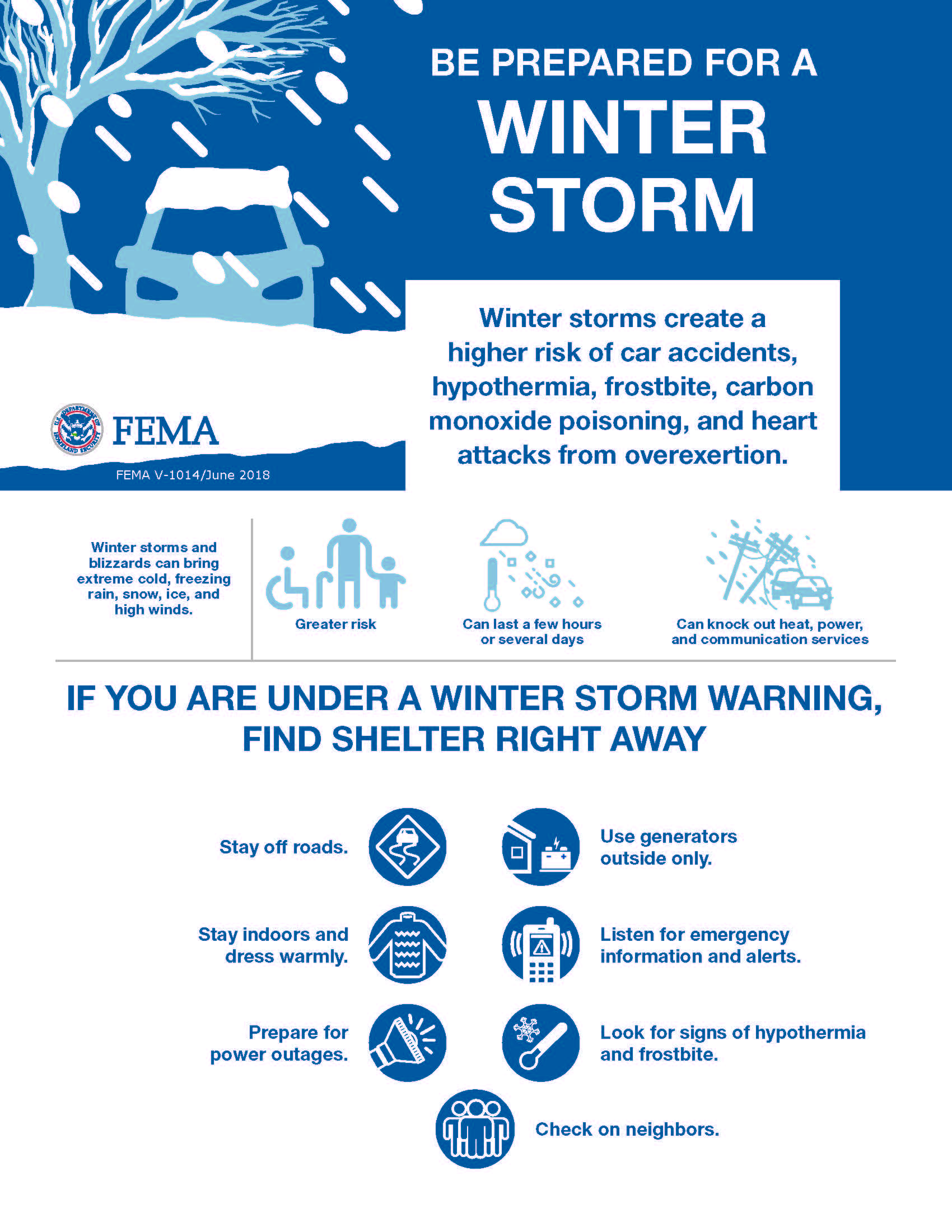
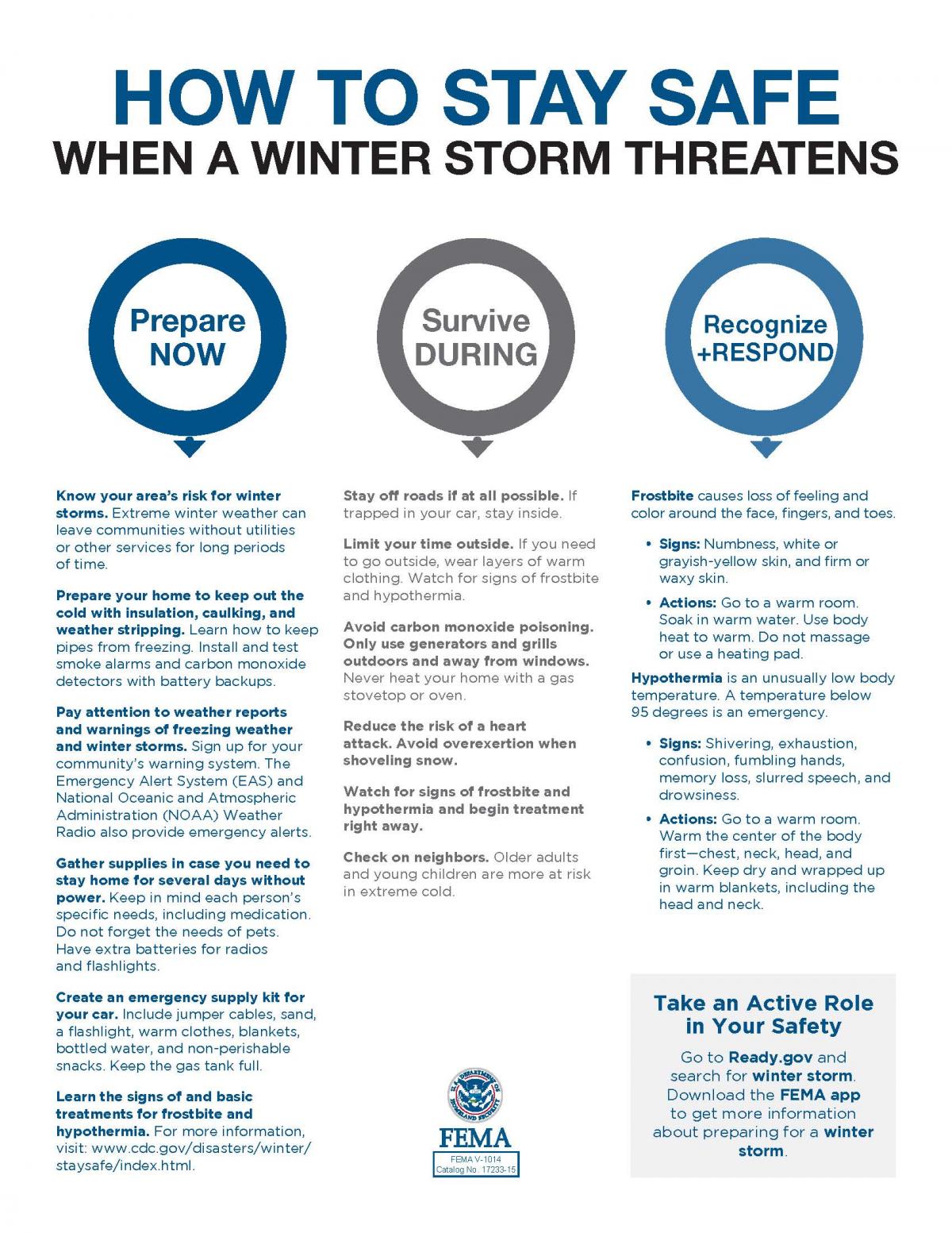
Stay aware of the extreme cold temperatures coming into Utah from the north, starting Sunday, January 29, 2023.
We will also have winds from Sunday into Monday. These very cold temperatures, along with the wind could drop wind chill factor temperatures down between 10 to 20 degrees BELOW ZERO!
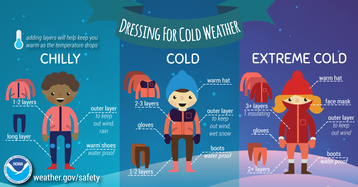
Consider your circumstances and take precautions. If you go out in these conditions, frostbite can occur quickly. Make sure you wear winter clothing that will protect open skin.
Other extreme cold weather tips:
* Re-consider outdoor pets that normally are able to manage more common temperatures.
* Check the cold temperature capability of the antifreeze in vehicles.
* Leave a pencil-sized stream of water trickling from faucets, especially when the pipes run along walls that are exposed to the outside.
*Check on elderly neighbors.
After the winds die down on Monday, temperatures will stay very cold for a couple more days.
Stay tuned to your local news and weather, tv, and online sources. Or follow the National Weather Service at https://www.facebook.com/NWSSaltLakeCity/
Please share this message with your social media groups and neighbors who may not have access to social media.
-Box Elder County Emergency Management